The Map can refer to both one of the basic menus/windows in the game, as well as to various world maps that have been created by players to aid in navigation. One can open the in-game Map window by clicking on 'View' in the menu bar and then selecting 'Map'. Alternatively, the map can be opened by pressing the 'Command' key and the 'M' key at the same time (⌘ + M). All world maps, on the other hand, exist independently of the game and must be found online.
World Map
Over the years, various players have constructed maps of the entire surface of Oberin. Their efforts, which have proven indispensable to explorers old and new, are listed here.
Fourth Era
Everything happening in Oberin today takes place in the "Fourth Era", which is an In Character term describing the current period of Oberin's history. In Out of Character terms, it began when Oberin returned to public beta in April 2005. This era is generally synonymous with the OOC term "018", which refers to a now-antiquated version number. Strictly speaking, however, the current map (and Version 018) have existed since around 2003 – but security issues at the time resulted in the game regressing to closed beta for a period of over two years.
- Alec's Map
- The most comprehensive and up-to-date map was provided by Alec in ~2017, and uses the SRCN map as a base.
- Hayate's Map
- Hayate submitted this artistic map to the Oberin website in 2010.
- Tiphereth's Map
- The Tiphereth map was created in 2008, and was the first map to be made in a more artistic, In Character style.
- SRCN Map
- This classic map, while considerably outdated, is still the easiest to find via search engine. Created by Starkenden in 2007.
- Monja's Map
- This is possibly the earliest complete map of the 018 world, created just over a month after Oberin returned to public beta. It lacks several islands and geographical features, but is otherwise accurate.
- Yuxu's Map
- This map sketch, while very rough, is the first known attempt to plot the geography of the new Oberin map. Uploaded on April 19th, 2005.
First Era
The First Era of Oberin takes place many hundreds of years before the Fourth Era. In OOC terms, it corresponds to the original public beta, which lasted roughly from 2001 to 2003. It is also referred to as Version 017. This era concluded with the cataclysmic Black Plague, which resulted in the destruction of human civilization, and a complete reshaping of the world's geography – hence the map change in Version 018.
- Pipe's Map
- This is one of the only surviving maps from the First Era. It was created in 2001, and thus lacks all of the guild halls that were added over the course of the next year.
Map Window
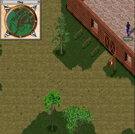
The Map window.
In the map, all directions have been rotated 45° counterclockwise from a typical real world compass rose. For example, 'north' on the Oberin map is in the same location as 'northwest' on a real world map.
Colors on the map generally reflect the actual appearance of a location. Green corresponds to grass, while dark green corresponds to trees. Paths, stables, roads, and most buildings are brown on the map. Temples, walls, and pavement (such as in Andris) appear off-black. Sand is beige, water is light blue, rocks are gray, and snowy terrain is white. The map is completely black when the player is underground.
When the Map is not the active window (i.e. when another window has been clicked on), the colors will appear somewhat darker. Clicking on the Map will bring it back to the foreground and thus brighten the colors on the Map. Night Vision has no effect on the brightness of the Map.
Rangers can use their Tracking ability to locate nearby creatures. When a Ranger successfully tracks, dots of various color that describe a creature will flash repeatedly but briefly on the Map. Rangers are completely unable to track when underground.